
Another paper given
… at the 1st annual Tolkien Symposium prior to ICMS Kalamazoo:
The river Swanfleet: A journey from the Misty Mountains to flat fenlands and half-way back again; or, How the discovery of Tolkien’s annotated map of Middle-earth by Blackwell’s Rare Books in Oxford extricates Pauline Baynes’ cartographic reputation from the marsh of Nîn-in-Eilph
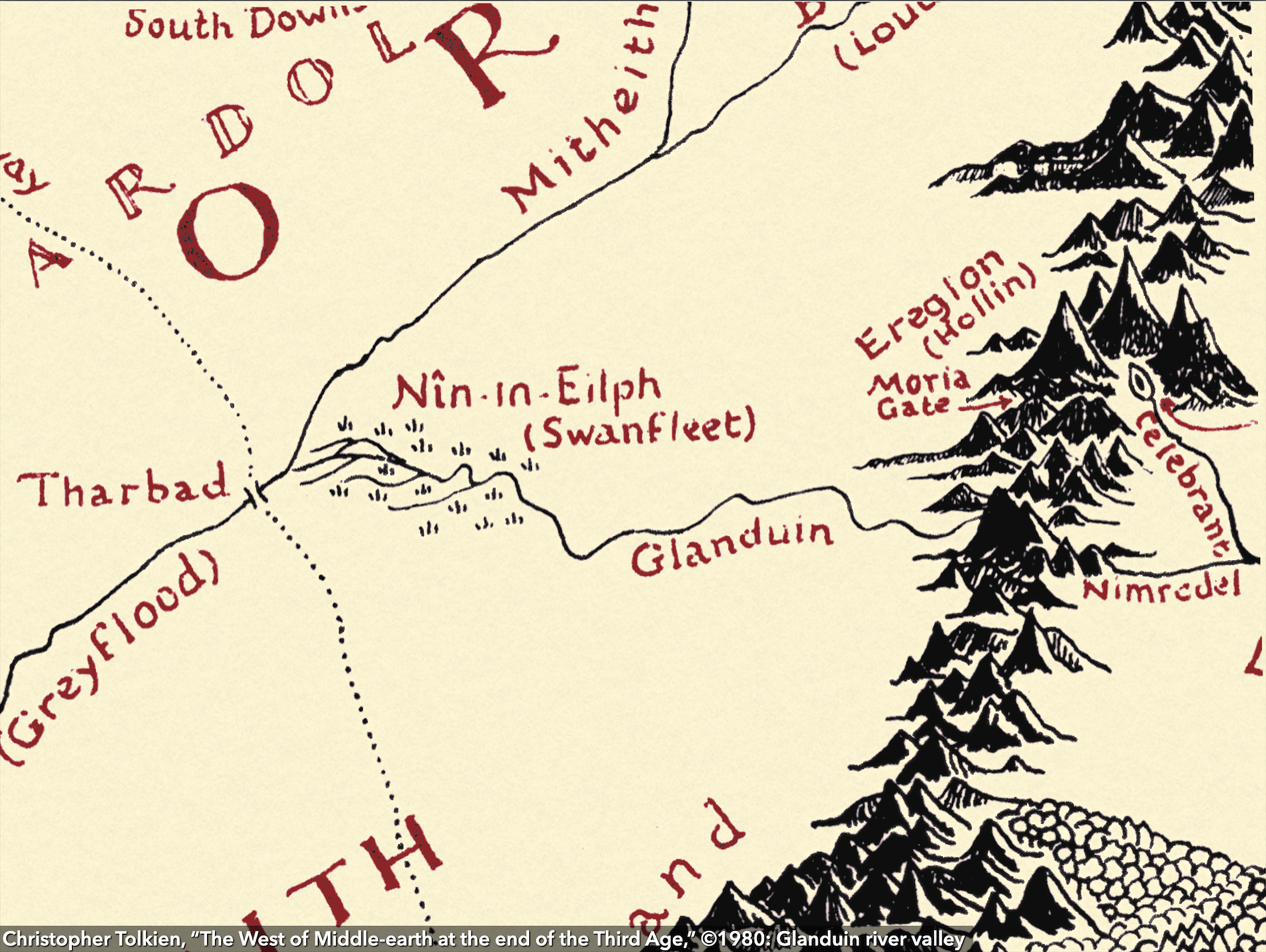
Just as Christopher Tolkien’s exacting work in The History of Middle-earth has provided both the basis for and the standard with which we measure research into his father’s Middle-earthly subcreation, so too have his maps of the west of Middle-earth at the end of the Third Age long served as both the canonical representation of Middle-earth and the gauge with which we have measured all subsequent Media-terrestrial cartography.
The recent discovery of the map that J.R.R. Tolkien himself annotated for Pauline Baynes’s reference in producing her 1970 poster map, however, now provides a welcome opportunity to explore some issues that J.R.R. Tolkien said “give some trouble,” and which Christopher Tolkien agreed have “bedevilled … representation on the maps.” Of particular interest is the mysterious relationship of “Swanfleet” to the fens of Nîn-in-Eilph and the Glanduin River, about which Christopher Tolkien, Wayne Hammond and Christina Scull, and Karen Wynn Fonstad have all implicitly or explictly concluded that Baynes “misunderstood.”
This paper demonstrates that Baynes had it right all along, and that this is a rare case where Christopher Tolkien went astray, taking Hammond, Scull, and Fonstad with him. Along the way, we will also make brief excursions to several little-known rivers in Gondor and through the famed vineyards of Dorwinion.